Besides the vector OpenStreetMap road maps and the Shuttle Radar Topographic Mission terrain elevation maps, YAAC can also display scanned raster map images. The View->View Raster Maps menu choice allows enabling use of rescaled raster maps, loading new raster map images into YAAC, and deleting no-longer-used maps.
Clicking the menu choice opens a dialog box displaying all the currently loaded raster maps, and controls for adding and deleting map images.
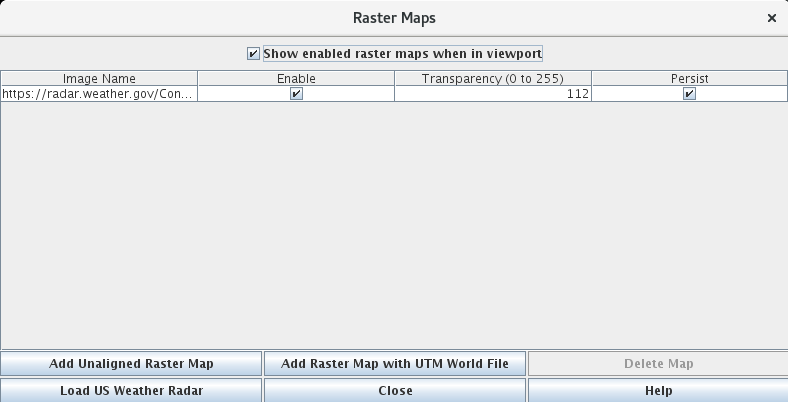
Clicking the enable check boxes enables or disables displaying raster map images; note they will only be visible if the geographical area they cover is visible in the map viewport.
The transparency value sets the alpha (opacity) value for all defined pixels in an overlay, where 0 is completely transparent (like disabled, except less efficient) and 255 is completely opaque so nothing behind the raster in layer stacking order will show through. It defaults to 112 (the fixed value used in previous builds of YAAC), but can be adjusted, and the adjustment will be persisted with the rest of the raster image parameters.
The persist checkbox specifies whether the raster overlay should be remembered across restarts of YAAC. Note that the persistence will be ignored if the raster file cannot be found at YAAC restart time.
To add a new raster image to YAAC, first ensure the map window is displaying the geographical area where the raster image belongs, then click the Add Raster Map button. A file selection dialog will appear to choose the image file to import; once the image is opened, it will appear superimposed on the map window at the image's native pixel resolution. At this point, the user can click and drag points in the image to align the raster image with the background street map and the degree graticule.
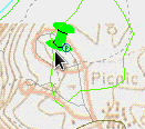
Once you have the image properly aligned, use the temporary drop-down menu labeled "End Pinning Image to Map" to "Save" or "Discard" your work with the image. This image will now be remembered by YAAC for future use.
YAAC can also download weather map data from the U.S. National Weather Service. Click the "Load US Weather Radar" button, and YAAC will access the NWS website to collect the current weather radar image. Note that this is the same current radar mosaic image as viewed on the NWS website https://radar.weather.gov/. Note that this will not work if encrypted HTTP (HTTPS) has been disabled.
Additional buttons may appear if you have installed plugins that provide other raster image sources. Note that buttons for images that can only be loaded over encrypted HTTP network connections will be disabled if YAAC is configured to only use unencrypted network connections.
Plugins can add extra buttons to this panel for more types of automatically downloaded raster overlay images.